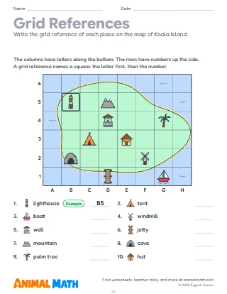
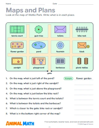
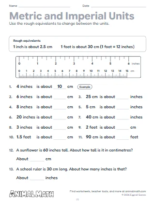
Six pages on maps with scales, compass points and turns. Page 1 changes map distances into real ones and back with scales such as 1 cm = 200 m, then reads three scale bars drawn at actual size. On page 2 children measure between places on an island drawn to the scale 1 cm = 200 m, in a straight line from dot to dot, and work out each real distance; there is a centimetre ruler to cut out at the bottom. Page 3 is an island on a grid of 100 m squares: children follow paths such as 300 m east, then 100 m north, write the square and what is there, and say how far and which way one place is from another. Page 4 is about turns in degrees on an eight-point compass: which way you face after a turn such as 270° anticlockwise, and how many degrees a turn is. On page 5 they follow routes that mix turns and distances, then write the routes of two paths drawn on the map. On page 6 they make a map of a camp from clues, on squares 2 cm across at 1 cm = 50 m, and answer questions about it. The first problem on each page is a worked example. Print at actual size (100%) so the scale bars, the map on page 2 and the ruler measure true.
Take the class outside with a trundle wheel or a long tape and pace out 100 m, so children know how far it is. Draw a plan of the school field to the scale 1 cm = 10 m together. For turns, have children stand facing north and call out turns such as "90° clockwise" or "a three-quarter turn anticlockwise", then ask which way they face now.
Look at a map of your town or a walking track with your child and find its scale. Measure a straight line between two places on it with a ruler and work out how far that is. Write directions for a walk round the house or garden in steps and turns, such as "walk 5 steps north, turn 90° clockwise", for someone else to follow.
This pack supports the following Common Core State Standards for Mathematics:
© Copyright 2010. National Governors Association Center for Best Practices and Council of Chief State School Officers. All rights reserved.
Reading and making maps with scales, grid references, compass points and turns in degrees. Students change map distances into real ones, measure on a map drawn to scale, follow and describe paths in metres and turns, and make a map from clues.
Tell us what to make next, or build your own with a worksheet maker.
This worksheet is free to download, print, copy, and hand out in your classroom or at home. You do not need to create an account, and there are no watermarks on the PDF.